- 27
- 49shares
Driving Titus Canyon: Ghost Towns and Desert Views
Most people enter Death Valley on paved highways and stop at the familiar overlooks. The better story starts on a graded dirt road outside Beatty, Nevada. The 27-mile one-way Titus Canyon Road climbs into the Grapevine Mountains, tops out near 5,250 feet at Red Pass, then drops through colorful rock, a short-lived mining town, and a narrowing limestone gorge before opening onto the valley floor. It is the park’s most popular backcountry drive for a reason: the scenery changes fast, the history is sharp, and the final stretch feels like you are threading a vehicle through a slot canyon.
You can also reach the lower canyon from the park’s west side, park at the entrance, and walk in. That version is simpler and still worthwhile. The full drive from Nevada Highway 374 is the version people remember.
Starting from Beatty, Nevada
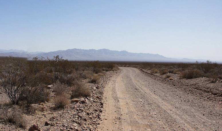
Beatty makes a practical overnight base. The signed turnoff for Titus Canyon Road sits roughly six miles west of town along Highway 374 (Daylight Pass Road). It is marked, but easy to miss if you are focused on the highway. Many drivers stop at Rhyolite Ghost Town first, a short detour that sets the mood with its own mining ruins before the dirt road begins.
The first ten miles run across relatively flat desert. Expect some washboard and the usual gravel roughness. The road then turns into the foothills and begins the long climb.
Red Pass and the High Country
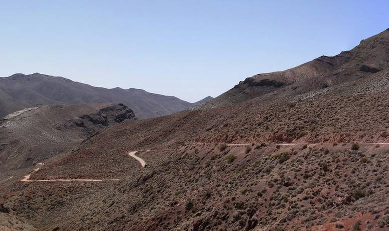
Elevation gains steadily as the route winds through the Grapevine Mountains. Red Pass, at about 5,250 feet, is the high point and a great place to stop. Layered rock in reds, greens, and grays spreads out in every direction. These formations record the region’s long geologic history—limestone, folded strata, and nearby fossil beds, including deposits tens of millions of years old in Titanothere Canyon. Pull over safely, walk a short distance from the vehicle, and take in the view. From here, the road is strictly one-way. The only direction left is downhill toward Leadfield and the canyon.
Leadfield Ghost Town
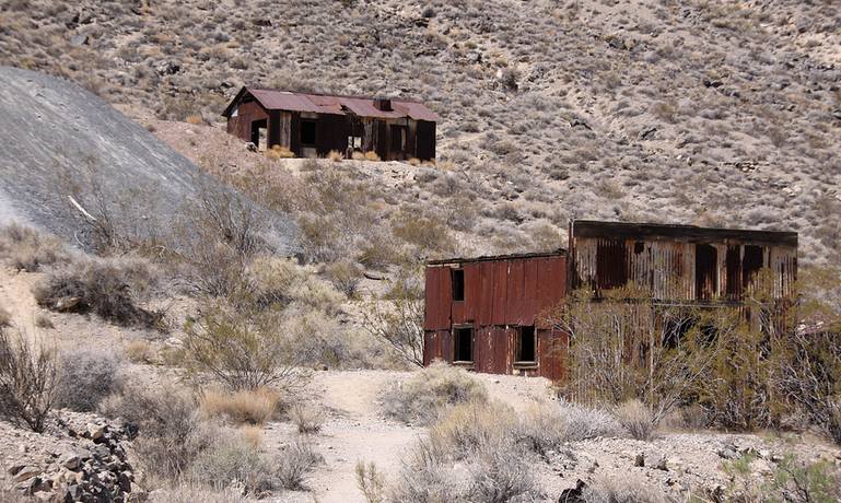
Leadfield sits at the head of the canyon and served as a working camp for roughly two years. In the mid-1920s, promoter C.C. Julian advertised rich lead deposits and sold claims to investors. Marketing materials even suggested steamboats could reach the area on the Amargosa River—an idea that ignored both the river’s usual dryness and its distance from the site. Tunnels were blasted, a few buildings went up, and a road was pushed up the canyon to bring people in. Significant lead ore never appeared. By 1926, Julian had left with the money. The post office closed the next year, and the remaining residents followed. Today only a handful of rusting structures, foundations, and mine workings remain. The site is on the National Register of Historic Places. Walk carefully—mine openings can be unstable—and leave everything exactly as you found it.
Klare Spring and the Descent
Below Leadfield, the road enters the main canyon. Limestone walls rise on both sides as the route follows the wash. A short distance down, Klare Spring provides a small, reliable water source used by desert bighorn sheep. Native American petroglyphs appear on nearby rocks; some clearly depict animals that still live in the area. Parts of the panels have been damaged by later graffiti, so look but do not touch. A short walk from the road shows more of the spring, the vegetation it supports, and the surrounding geology.
The Narrows
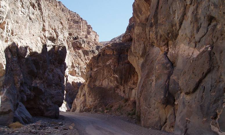
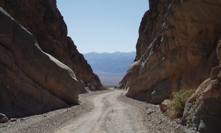
The final mile and a half defines the drive. The road follows the creek bed through a limestone gorge that tightens to less than 20 feet wide in places, with walls rising hundreds of feet. In the tightest spots, the canyon feels more like a tunnel than an open route. The surface here is often the roughest of the entire trip. Many drivers stop and walk a short distance ahead to scout the line before driving it. When the road is open, hikers frequently enter from the west-end parking area and walk up the narrows, so stay alert for people on foot. Once you exit the canyon, the view opens suddenly onto Death Valley below. The last few miles of road are two-way and connect with Scotty’s Castle Road.
Planning the Drive
Expect two to three hours of pure driving time and four hours or more once you add stops for photos, Leadfield, Klare Spring, and the Narrows. High-clearance vehicles are recommended. Many high-clearance two-wheel-drive vehicles complete the route in dry conditions; four-wheel drive adds margin after rain or on rougher surfaces. Avoid low-clearance passenger cars and anything longer than about 25 feet. There is no cell service along the road, so carry a full tank of gas, plenty of water, a spare tire, basic tools, and emergency supplies. Summer temperatures regularly exceed 100°F, and the road is not recommended in summer. Flash floods can close the route quickly—never enter if rain is in the forecast. Check the National Park Service conditions page and local weather before you leave Beatty or Furnace Creek.
Is Titus Canyon Road open?
Titus Canyon Road closed on October 2, 2026, for major repairs after repeated flood damage and is expected to stay closed through May 2027. Flash flooding in August 2022 and additional storms in 2023 tore up the route with washouts, boulders, and eroded sections. Preliminary grading and cleanup allowed a temporary reopening earlier in 2026. Current work still focuses on improving drainage, installing rolling dips to move stormwater off the roadway, reinforcing rock at wash crossings, and stabilizing an eroding section near Red Pass. The National Park Service has closed the one-way section to vehicles; hikers and cyclists are also restricted during the work. Confirm the latest status on the park’s conditions page before you plan around this drive—dates can shift.
Titus Canyon packs a full desert story into 27 miles: the climb into the Grapevines, the brief boom and quick collapse of Leadfield, the quiet spring and rock art at Klare Spring, and the final squeeze between limestone walls that open onto the valley floor. Done in the right season and the right vehicle, it is one of the drives that stays clear in memory long after the gravel turns back to pavement.
Discover more from Daytrippen.com
Subscribe to get the latest posts sent to your email.
I have an oversize Ford Expedition and a nervous spouse is it possible to do the trail without any hesitation with a large vehicle that size and not making my wife question another one of my decisions?
I made it in a Ram Rebel. I would check with the park service for the current road condition. There has been rain and flooding in the valley
Can you stay overnight?
Hello Gregory
Camping is not allowed along Titus Cany road inside Death Valley National Park. If you are looking for an offroad camping adventure you might want to check out the Mojave Road. https://daytrippen.com/old-mojave-road-4-wheel-drive-adventure-trip/
Another option for driving through Titus Canyon is to stay overnight at Furnace Creek Resort and rent a jeep or take a guided tour.
Farabee’s Jeep Rentals offers Titus Canyon Tours departing from Furnace Creek Resort mid-September to mid-May. Tours are 2-person minimum. $145.00 per person.
Farabbe’s also rents Jeeps by the day for about $200.00 a day so you can venture out on your own.