Mojave Road Off-Road Trip: Landmarks, Camping, and Tips
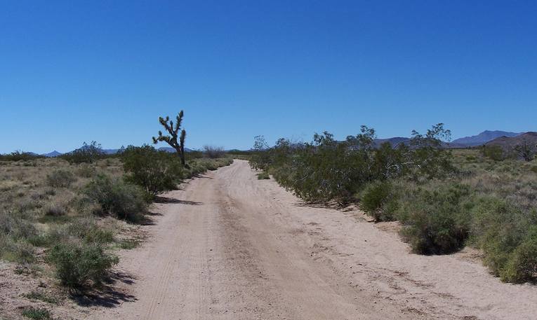
The Old Mojave Road is one of the most rewarding historic routes you can still drive in Southern California. It stretches about 140 miles from the Colorado River, through Mojave National Preserve, and west to Afton Canyon near Barstow. Long before pavement, this corridor carried Indigenous traders, Spanish expeditions, mail riders, soldiers, and settlers across a landscape defined by scarce water and long distances.
Today the same line of travel is a favorite multi-day 4WD trip. The modern track does not match every original wagon rut, but it stays close enough that the desert still feels older than the highways that now bound it. Most groups take two or three days. A one-day push is possible, yet it leaves little time for the ruins, mailbox, dry lake, and canyon that make the route worth doing.
What to Know Before You Leave the Pavement
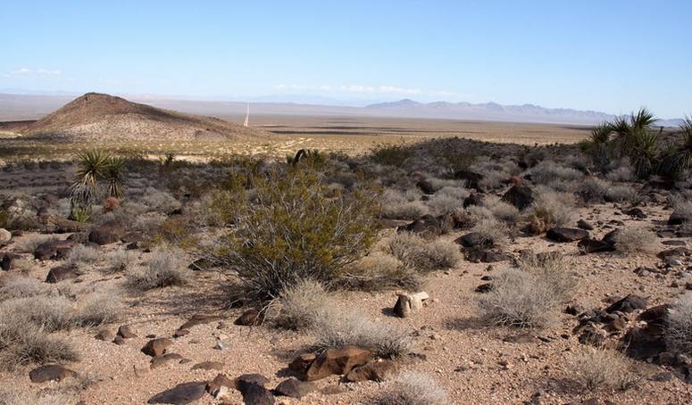
Most of the road sits inside Mojave National Preserve. It is not graded on a regular schedule. Sand, rock, washouts, and changing lakebed conditions are part of the deal. The National Park Service currently treats the Mojave Road as a 4WD-only route and recommends high clearance, heavy-duty off-road tires, and a low-range transfer case. All-wheel-drive SUVs are a poor match for several sections. Travel with at least one other vehicle when you can. Cell service is unreliable, and a recovery can be many miles from help.
Only street-legal vehicles are allowed inside the preserve. Jeeps and trucks licensed in any state are fine if they meet California street-legal standards. ATVs, UTVs, side-by-sides, and other vehicles that rely on green- or red-sticker programs are not permitted. Stay on existing open roads. Cross-country travel, new tracks, and driving in washes are prohibited and enforced.
Groups of more than seven vehicles or 25 or more people need a Special Use Permit, and processing can take up to a month. No entrance fee or registration is required for ordinary travel. Dennis Casebier’s Mojave Road Guide remains the classic mile-by-mile companion. Check current road conditions with the preserve before you roll, especially after rain. Soda Lake and summer monsoons can shut the route down with little warning.
Spring and fall offer the most comfortable temperatures. Winter days can be pleasant while nights drop below freezing. Summer heat is severe, and the preserve does not recommend travel then.

Fort Piute: First Water and Stone Ruins
From the Colorado River, the first major stop is around mile 23 at Fort Piute. The outpost began about 1859 as Fort Beale, named for Lt. Edward F. Beale and his camel-road surveys. After the Civil War, it was reoccupied as Fort Piute to protect mail and emigrant traffic, then abandoned for good by the late 1860s. Stone foundations and rifle ports are what remain. Camping is not allowed within a half mile of the site. Stay off the walls so the ruins last.
Piute Creek is one of the rare stretches of perennial water in the preserve. Indigenous people used this spring for thousands of years, and the same water later made the wagon road possible. From here the track drops into Lanfair Valley, a wide basin of yucca and Joshua trees. Homesteaders and ranchers once ran cattle and worked mines across this country. Almost none of those claims remain.
The School Bus Location, Penny Tree, and Indian Hill
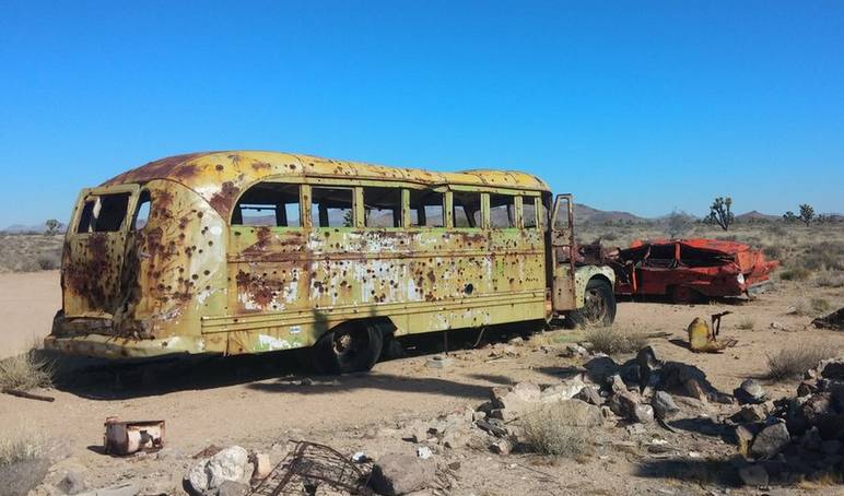
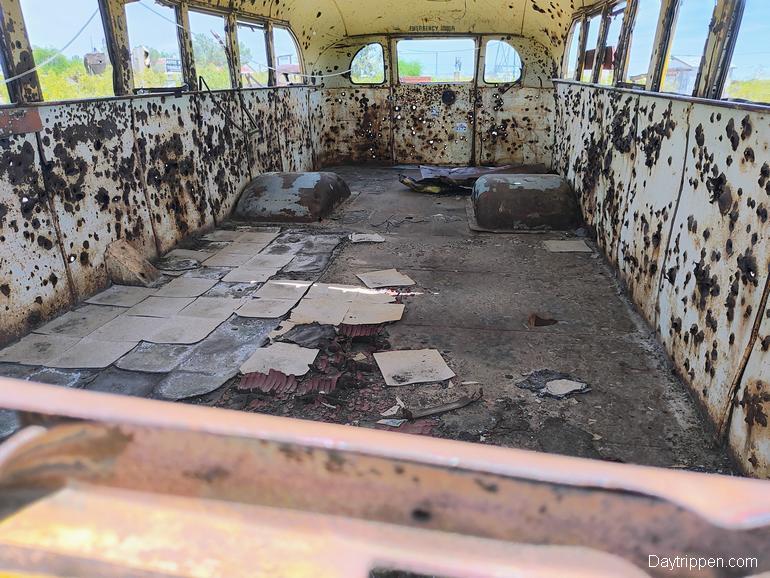
Around mile 35, travelers used to find an abandoned school bus, shot through and rolled more than once. It was a ready-made photo stop. The bus has been moved to the Mojave Desert Heritage & Cultural Association in Goffs, California, so plan that side visit if you want the relic.
At about mile 41, just past Indian Hill and Indian Well, most groups pause at the Penny Tree. A rusty can hangs from a Joshua tree. Tradition says you add a penny for luck. It is a small ritual, but it marks how this road still works as a shared traveler’s path. Lanfair Road is the first easy bailout. The pavement sees little traffic and can take you back toward Interstate 40 via what remains of Goffs. If you stay on the Mojave Road, the next natural overnight zone appears near mile 50.
Rock Spring, Government Holes, and the Mojave Rock House
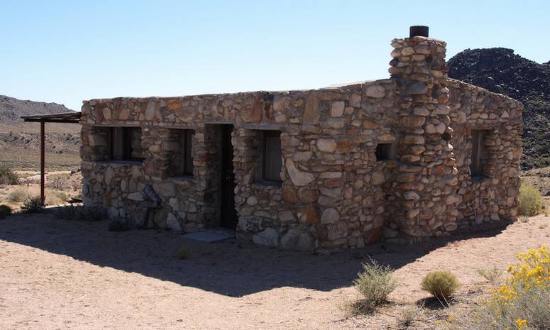
Rock Spring and Government Holes offer several existing campsites. If one cluster is full, try the other. Reuse disturbed ground, keep camp at least 200 yards from water, and skip dry washes. Flash floods rise fast in this country. Near Rock Spring stands a stone homestead cabin built by Bert George Smith. He used the rock at hand, which is why the building still stands. Smith lived here from 1929 into about 1950. Many travelers call it the Mojave Rock House. Walk the site, leave the walls alone, and picture two decades of desert isolation, with little company and less shade.
Kelso-Cima Detours: Dunes, Depot, and a Way Back to I-40
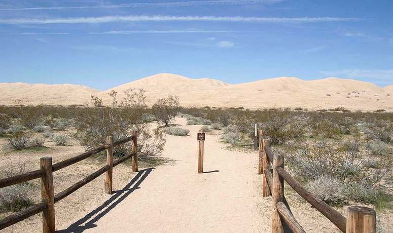
At mile 62, the Old Mojave Road crosses paved Kelso-Cima Road. This is a natural place to stretch the trip. Kelso Dunes and the restored Kelso Depot are close enough to justify an extra day. The depot visitor area and dunes access road give you water, restrooms, and a change of pace. Kelso Road also offers a clean exit to Interstate 40 if weather, mechanical trouble, or time force an early finish.
The Mojave Mailbox and the Lava Tubes
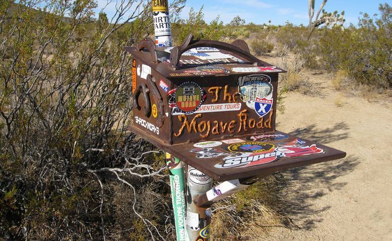
Continue to about mile 74 for the Mojave Mailbox. Friends of the Mojave Road placed it so travelers can sign in. Look for a notebook, read a few pages, and leave a note about your own crossing. It is one of the route’s best community markers.
A popular side trip sits about three miles north of the road: the lava tubes. Bring a flashlight and watch your footing. Access can be rough. The preserve has warned that some approaches may require a heavy-duty 4WD vehicle, and large groups have damaged parking areas near the site. Stay on existing tracks and keep the group small.
West of the mailbox, the trail runs near Kelbaker Road through small dunes and cinder cones. After you cross the pavement, the trip’s character changes again.
Soda Lake and Travelers Monument
Soda Lake is usually dry on the surface, yet moisture can linger just underneath. After wet winters, runoff from the Mojave River can turn the playa into mud that swallows trucks. Stay on the compacted Mojave Road. Tracks left off the route scar the lakebed for years, and the land on both sides is wilderness closed to vehicles. If the lake looks damp, detour on pavement rather than gamble on a tow that can cost more than $1,000.
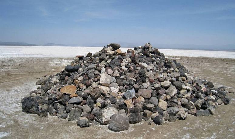
Near mile 100, at the west end of the lake, stands Travelers Monument. Generations of drivers have carried a stone across the playa and added it to the pile. Bring one if the tradition appeals to you, and leave the rest of the lakebed alone.
Afton Canyon and the Only Water Crossing
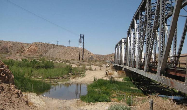
The last 40 miles follow the Mojave River wash past dunes and into Afton Canyon Natural Area, managed in part by the Bureau of Land Management. Steep walls cut by the river have earned the canyon a reputation as a smaller Grand Canyon of the Mojave. This is the only year-round water crossing on the entire trail. Depth changes with storms and season. Scout on foot, do not enter moving floodwater, and keep momentum if you commit.
Afton Canyon Campground has primitive sites with tables, fire pits, and vault toilets. From the canyon, you can continue toward Barstow and Interstate 15, or use Afton Road as an exit if the river is too high.
One Day Run or Camping Adventure
You can run the full road with camping stops, or choose a shorter section for a day. Popular overnight areas include Rock Spring and Government Holes country, as well as existing sites along the western half of the route. Developed options at Hole-in-the-Wall and Mid Hills sit off the main line but work well if you want water and toilets.
Pack at least a gallon of water per person per day, extra fuel, a shovel, recovery gear, and a second spare if you have room. File a plan with someone who is not on the trip. Watch for desert tortoises on the road and give them space. Pack out every scrap, including toilet paper.
Guided outfitters run the route if you want local knowledge. Independent groups do it just as often. Either way, treat the Mojave Road as a historic path still in use, not a playground. The preserve stays open to this kind of travel only when drivers stay on the road, keep groups modest, and leave camps cleaner than they found them. More info on running the Mohave Trail, including permits, is available on the National Park Service website.
A Crossing Worth the Dust
The Old Mojave Road rewards patience more than speed. Give it two or three days, carry the water and recovery gear the desert demands, and you will finish near Barstow with a clearer sense of how people once crossed this country one spring at a time. Check the National Park Service Mojave Road page before you go, then point west from the river and let the miles stack up.
Frequently Asked Questions
How long is the Old Mojave Road?
The commonly driven 4WD route is about 140 miles from the Colorado River area to Afton Canyon near Barstow. The National Park Service describes the broader historic corridor as roughly 150 miles.
How many days does the trip take?
A determined group can drive it in one long day, but two to three days is the usual plan. Three days leaves time for Fort Piute, Kelso Dunes, the lava tubes, and a slower crossing of Soda Lake and Afton Canyon.
Do I need a 4WD vehicle?
Yes, for a safe, complete trip. The preserve currently recommends high clearance, off-road tires, and low range. The road is not a good choice for all-wheel-drive crossovers.
Are side-by-sides and ATVs allowed?
No, not inside Mojave National Preserve. Only street-legal vehicles may use the road. Green- and red-sticker programs are not recognized.
Do I need a permit?
Solo travelers and small groups do not need a permit or entrance fee. A Special Use Permit is required for groups of more than seven vehicles or 25 or more people. Apply up to a month ahead.
Where can I camp?
Undeveloped camping is allowed on existing sites along much of the route, first come, first served, with a 14-day limit. Do not camp within a half mile of Fort Piute or Kelso Depot, within a quarter mile of paved roads, or within 200 yards of water. Afton Canyon Campground offers primitive paid sites near the west end.
When is the best season?
Spring and fall. Check Soda Lake and Afton Canyon conditions after any storm. Summer travel is discouraged because of extreme heat.
Is the old school bus still on the trail?
No. It was moved to the Mojave Desert Heritage & Cultural Association in Goffs, California.
Southern California Adventures Cool Things to do This Weekend
Discover more from Daytrippen.com
Subscribe to get the latest posts sent to your email.